Design Studio : Haltenbanken ASClient : MikkelparkenLocation : Kinsarvik, NorwayYear : 2021–2025
Mikkelparken is a family amusement park in Kinsarvik, Norway. The park had long used a hand-drawn illustrated map, but it had become outdated and wasn't ideal for navigation. The management wanted a new map that would be both visually engaging and geographically accurate, helping visitors discover and enjoy the park more easily.
Contributions
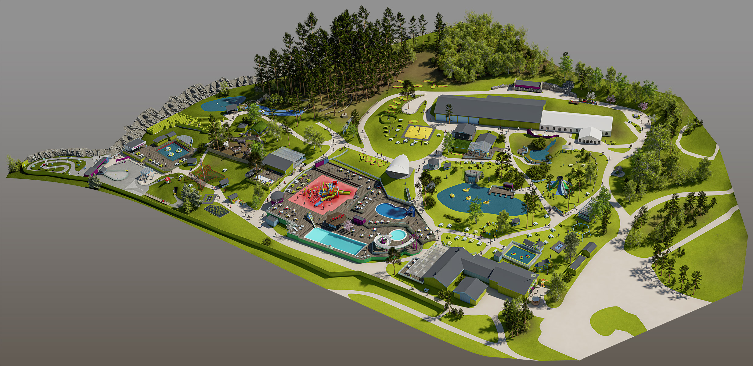
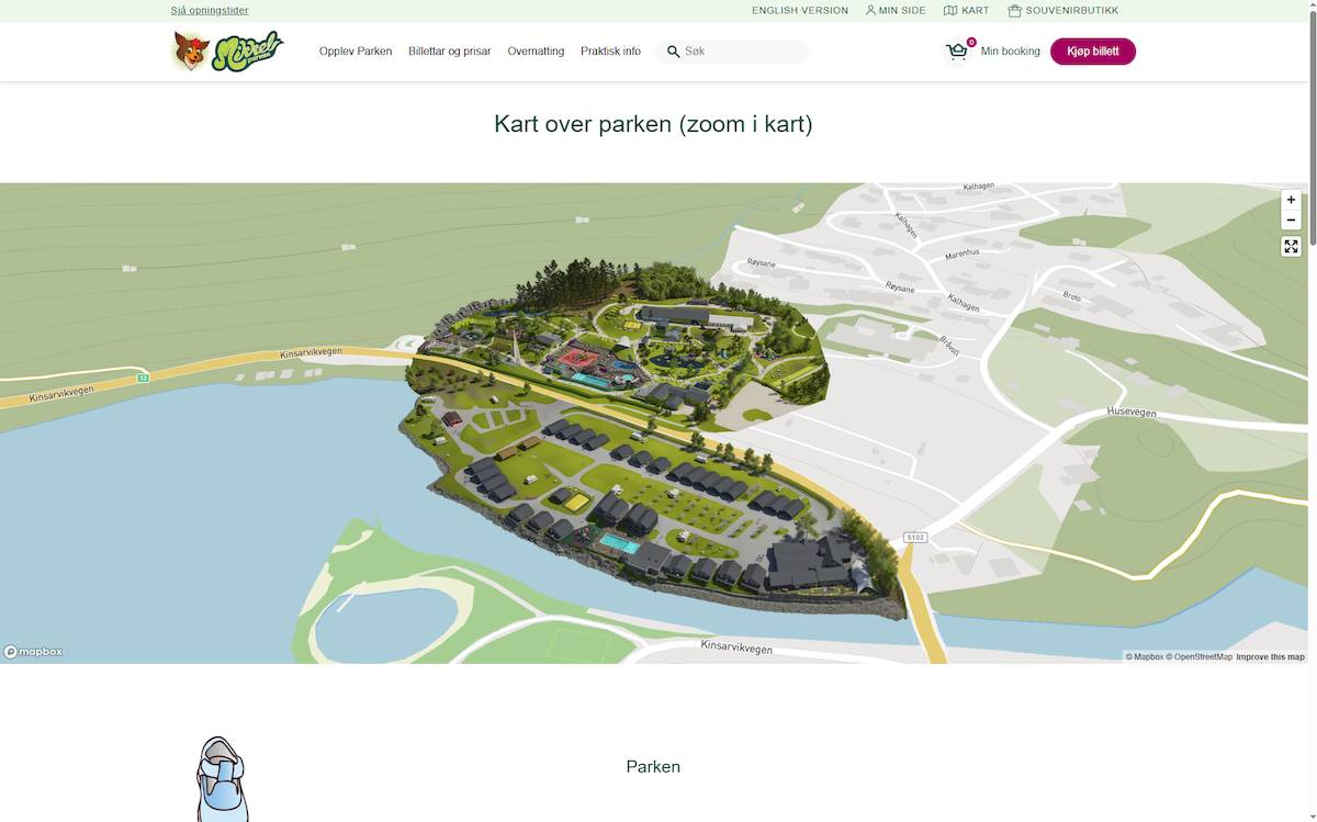
The project began as a request to create a 3D model of the park but soon expanded into delivering a fully functional, web-ready map for integration with WordPress. After performance testing with full 3D models, I concluded that a stylised 2D solution with a three-dimensional appearance offered the best balance between visual quality, clarity, and performance.
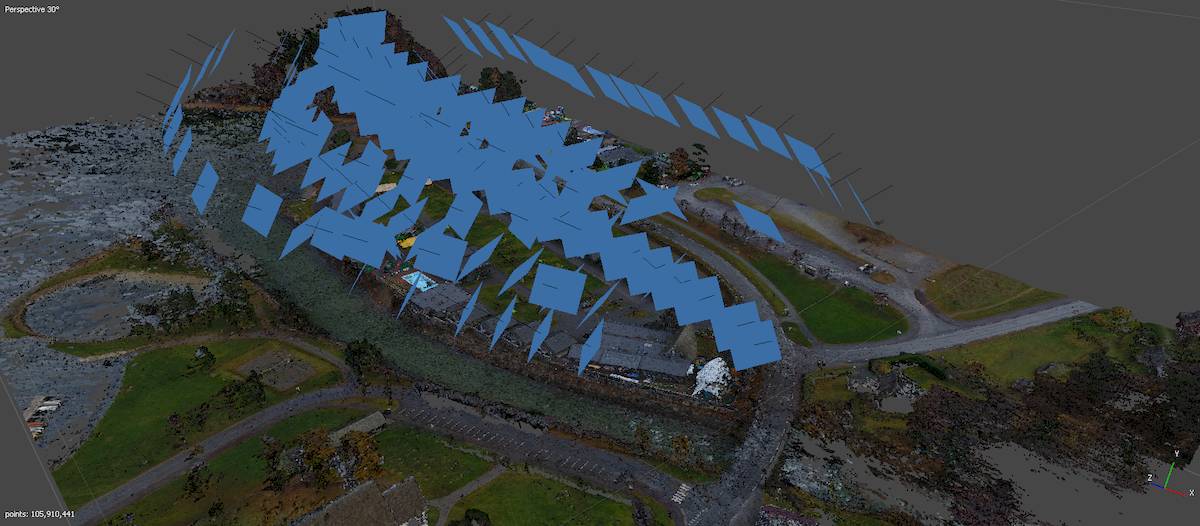
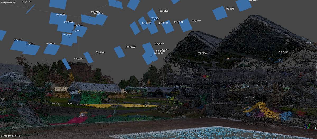
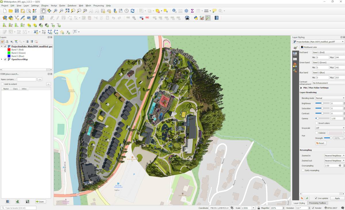
To ensure accuracy, Dag Instanes at Mikkelparken carried out drone photography of the park and I then processed the imagery with photogrammetry software to generate a base 3D reference model. This provided the foundation for a detailed, stylised version of the park created in collaboration with Haltenbanken AS, who were responsible for the visual design style and profile of Mikkelparken.
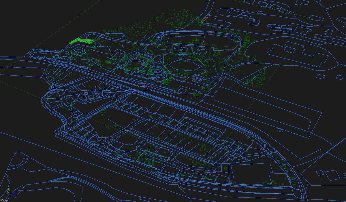
Then the entire park was modelled using an art style that fitted with the established visual profile for Mikkelparken. Using a re-projected render of the map, QGIS was then used to create a georeferenced image that could be converted to a tileset using MapBox. The symbols on the map were added using a custom icon and data set in Mapbox to make them dynamic and easy to update.
Results
The new map was seamlessly integrated into the Mikkelparken WordPress site and was well received by both the client and park visitors. It has remained in continuous use for several years and has been updated to reflect new attractions and facilities. Renderings from the same 3D base model were also used in printed materials, the park's booking system, and other communication channels, creating a consistent and recognisable visual experience across media.
Copyright © 2026 Studio Gohde.
All rights reserved.